Angelswing Drone Data Platform,
For All Stakeholders in Construction

Scalability for Project Managers
“It must be applicable in multiple job sites, and should support easy monitoring.”
“Product must continuously reflect on-site demand to demonstrate its effectiveness”

Convenience for Field Managers
“It should be easy to use even for busy and complex job sites.”
“Complex and cumbersome training procedures are burdensome for the job site.”
Angelswing Platform, a Cloud and Web-based Software
with Comprehensive Features for Construction Job Sites

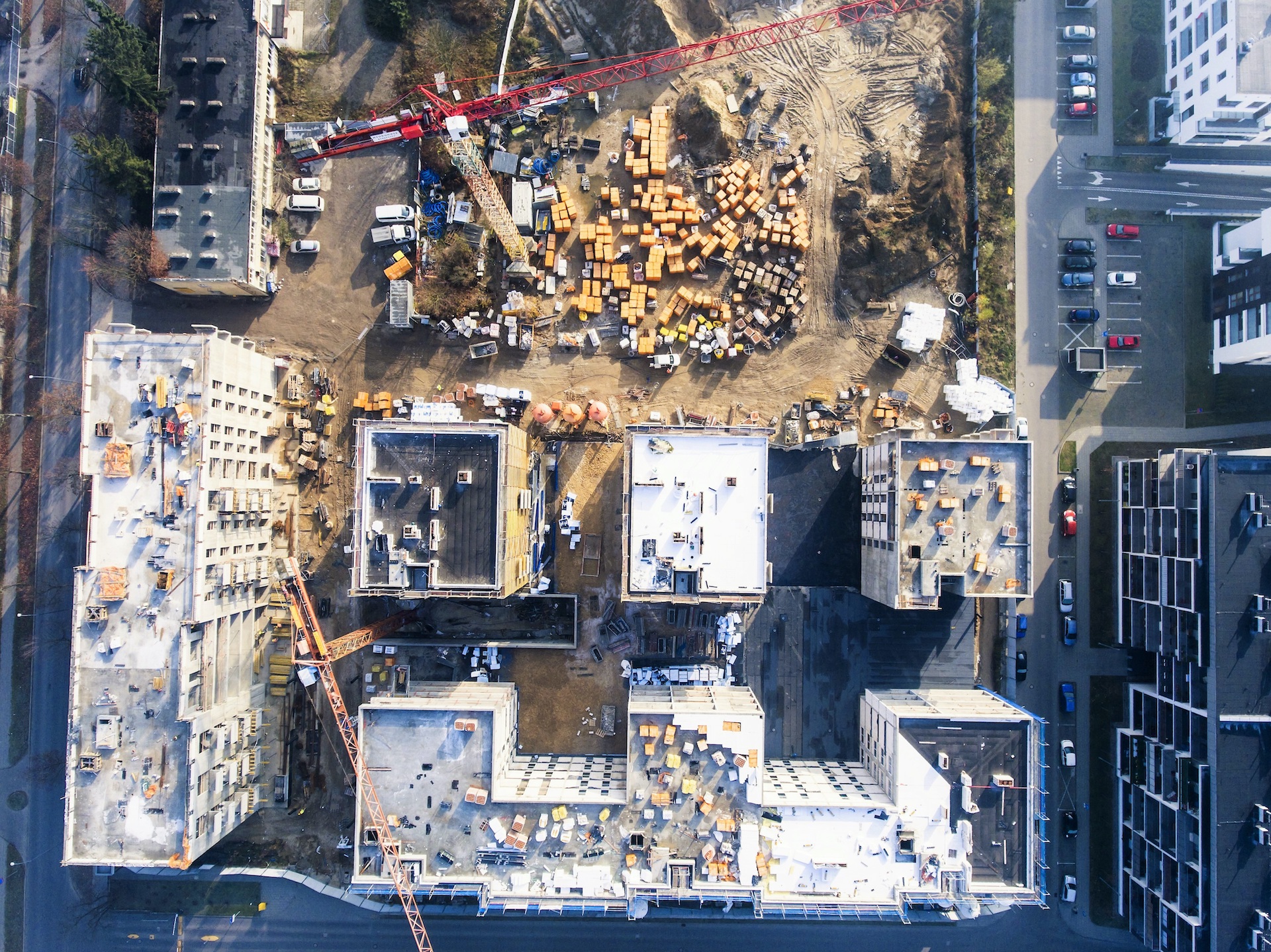
1. Reality Capture
New Paradigm for Construction Management
Offering a new job site management paradigm from the past to the future by capturing reality through drone data

2. Accurate Surveys
Easy, Fast, Accurate Measurements
Easily, Quickly, and Safely make measurements with just a few clicks on the web without visiting the actual job site.

3. Automated Data Processing
Automated Data Processing
Automatically Process and Calibrate Data Upon Upload
Simply upload data to Angelswing’s Platform for automatic cloud-based data processing.

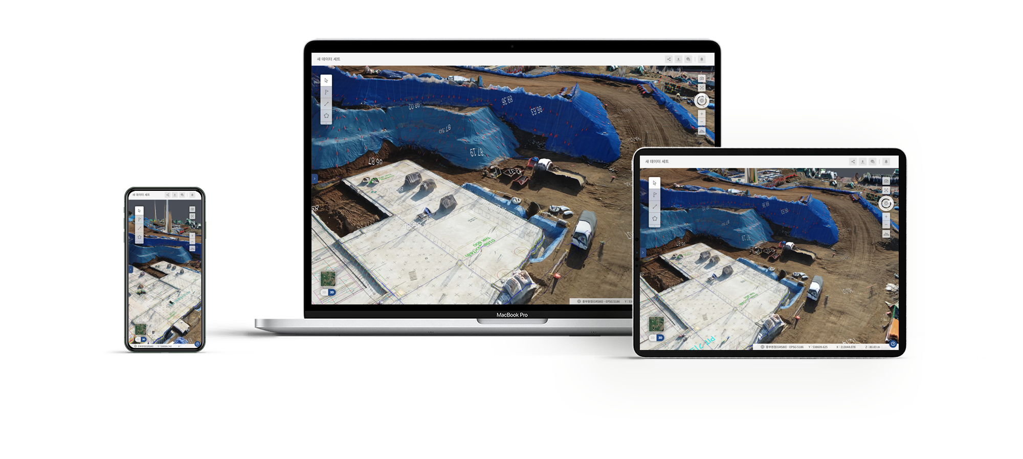
4. Ideal Use of Drone Data
Features Customized for Project Managers and Field Managers
Features Customized for Project Managers and Field Managers
Support seamless communication between the office and the job site with high compatibility of CAD software and full support for job site coordinate systems.
Datasets visualized in Angelswing’s Platform
Support 2D and 3D Models for Even More Realistic On-site Monitoring.
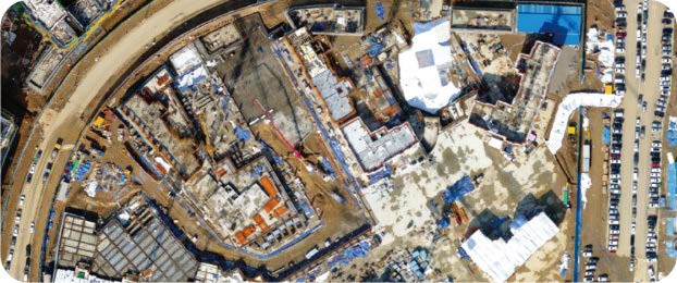
2D Orthophoto
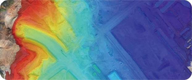
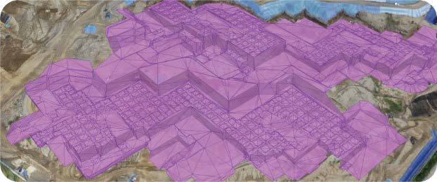
Digital Surface Model
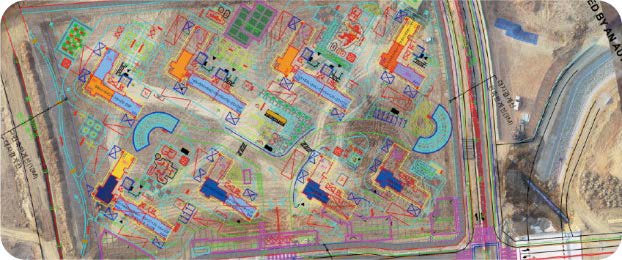
CAD Overlay
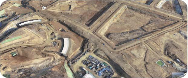
3D Orthophoto
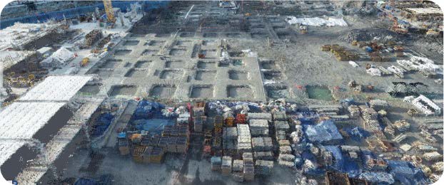
Point Cloud
3D CAD/BIM Overlay
Angelswing Platform Features
Wide Range of Support For Job Site Reality Capture and Survey

Marker creation
on precise locations

Measure Distances, Slopes, and Areas

Multiple Elevation Profiles

Volume Calculation and Comparison by Date

Design Based Volume Calculation